Ecology / Infrastructure
GIS Impact Assessment of European River Networks | EU AMBER

Tracsis Geo Intelligence Analytics helps you bring all that fragmented information together into a single, coherent framework, ensuring your teams can work with the right data, at the right time, in the right way.
Our solution can deliver demographic analyses across a range of variables, produce isochrone maps for drive time, walk time and buffer distance, export maps and reports and share user-configured map views with others.
Tracsis Geo Intelligence is deliberately architected to incorporate an organisation’s own spatial and tabular data and integrate with their existing Esri GIS licensing. Through our product development plan, we continue to tap into Esri services, in particular those for transportation.


With Compass Analytics, your organisation moves from scattered, siloed data to a unified, user-focused data ecosystem, supporting teams to make smarter, faster, and more confident decisions.

Our comprehensive analytics solution can generate instant demographic and accessibility analysis.
The user can choose a point location, select a mode of transport and time or distance variables e.g. drive time, walking time, or buffer distance, and run demographic analysis. The user can export this analysis as Excel or pdf reports.
Upon integration of the Esri Transportation Routing and Network Analysis services, this demographic and accessibility analysis runs against a route as well as a point feature.
Tracsis Analytics can also create ‘Community Infographics’. By selecting a region boundary, the user can quickly view infographic-type images summarising the demographic makeup of that area. Tracsis Analytics is set up to use Esri demographic data and can take in other national or regional data
Transform raw data into actionable intelligence, helping you prioritise resources, improve services, and make evidence-based decisions.
Combine GIS, operational, demographic, and third-party datasets in one accessible platform.
Our solution is built around your users so analysts, planners, and decision-makers can intuitively explore, visualise, and act on insights.
Establish a framework for consistent data management, ensuring reliability and compliance across your organisation.


With our Tracsis Analytics solution, we can incorporate additional data that will further refine demographic and accessibility analysis. We work with partner planning and consulting engineers to ensure all data is fit for purpose, sensible, and will contribute value to end user understanding of the analyses.
With its powerful, pre-built mapping and planning capabilities, Tracsis Analytics provides immediate value. Our strategic development roadmap outlines a clear path for future growth, with new features planned for implementation across various timelines


Tracsis Geo Intelligence provides comprehensive support through a dedicated help desk. We offer multiple contact channels including phone, email, SMS, and social media. Service Level Agreements are available to ensure guaranteed response times and support resolutions.
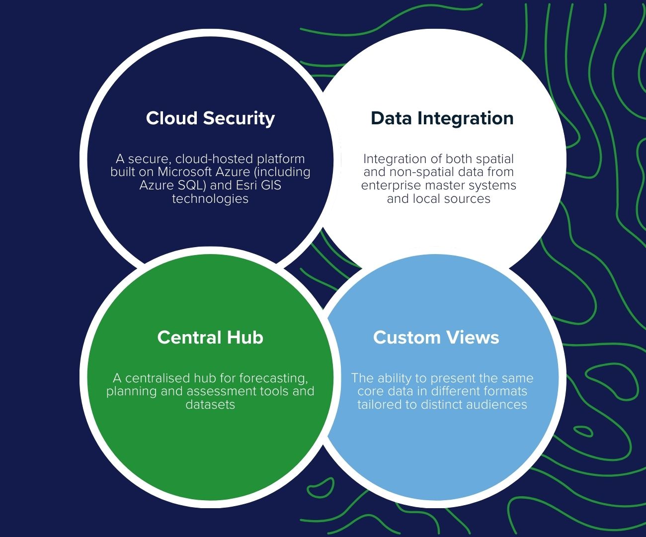
Tracsis Analytics is a fully managed SaaS solution hosted on Microsoft Azure, with secure Azure SQL data storage and encryption both at rest and in transit. It can also be deployed within an organisation’s internal infrastructure if required.
The platform leverages Azure services for resilience, security, performance and scalability, with continuous monitoring and threat detection. Its mapping interface is built using the ArcGIS API for JavaScript from Esri, delivering a modern, high-performance GIS experience.
As a multi-tenanted solution, it supports configurable themes tailored to different user groups. Originally developed as a decision-support tool, Tracsis Analytics has evolved into a flexible analytics platform offering powerful search, demographic and spatial analysis tools, and strong integration with clients’ GIS and enterprise data.


Get the answers you need.