Skip to content
services

Software Development

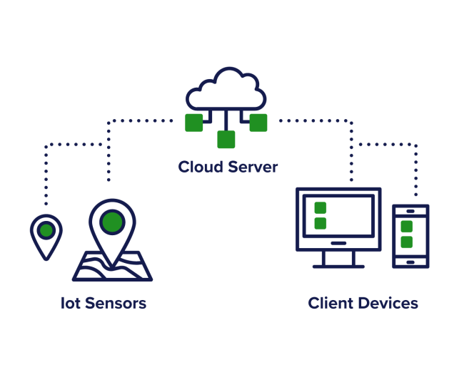
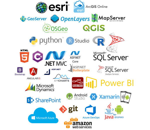
We are a highly skilled software development company with a focus on the Microsoft .NET stack, plus open source options. Our software skills cover web, mobile, database, workflow, UI/UX, analytics and hosting.

A Skilled & Experienced Team

We have an in-house senior so development team with an emphasis on agile development and code management best practices. Tracsis Geo Intelligence systems benefit from on-going structured support and planned updates and releases.

We bring strong industry experience to every project we undertake, and as committed partners, we add significant value to every success story we participate in.

Infrastructure

We make extensive & appropriate use of Cloud (AWS, Azure etc.) for scalable hosting and processing infrastructure, as well as in-house hosting configuration and support. Similarly, we utilise data streaming from IoT (Internet of Things) sensors to build bespoke, optimised data management and analysis solutions.

  • Scalable cloud infrastructure built on AWS, Azure, and other platforms
  • Custom in-house server configuration and hosting support
  • Real-time data ingestion and processing from IoT devices and remote sensors
  • Bespoke data pipelines designed for high availability and performance
  • Secure data storage and management aligned with industry best practices
  • Optimised environments for large-scale geospatial and transport datasets
  • Support for hybrid and on-prem/cloud infrastructure models

Systems software development

Our team of Microsoft .NET developers leverage the latest technologies to create class-leading web and mobile applications, particularly in the GIS and location data analytic fields. We use technologies such as Microsoft .Net to provide fast, stable server applications; and Xamarin and native coding to deliver mobile applications.

Our skill and experience in administering cloud services allows us to deploy secure, robust and high-performance solutions that can be easily scaled to match any demand.

Location Technologies

Our GIS background is reflected in the use of location technologies in our software development work. This includes effective use of digital map viewers, mapping widgets in systems such as CRM and doc management, GPS and clever spatial tools in mobile apps, and exemplary data management and analysis tools and skills.

Our Location Technologies

Open Source Technologies

Where appropriate we use open source technologies that fit to our needs, including Python, R, Open Layers, MapServer to name but a few. The advantages with open source software extend way beyond the cost savings on licence fees.

Open-source technologies are actively maintained and updated by a global community of millions of skilled and passionate developers. As new technologies evolve, open-source often leads the way and provide our team of software engineers and designers with the tools to develop cutting edge applications.  We have a core set of proven libraries and tools we use – ones that are robust and reliable.