Skip to content
Case Study: Infrastructure Transport & Logistics

National Road Asset Management | MapRoad AMS for Ireland’s Road Management Office

Find out how Tracsis Geo Intelligence, worked with the Road Management Office (RMO), the Local Government Management Agency and the Department of Transport to build a national, open-source platform that helps 31 local authorities manage over 102,000 km of roads and target c.€600m of road funding every year.

Every road, every local authority, one system

One centralised repository for Ireland’s road assets, used by every local authority to manage the road network through its life cycle.

Evidence-Based Investment

Condition, traffic and works data in one place, so funding is prioritised and reported transparently.

Captured on site, available instantly

Mobile apps let engineers record surface condition, speed signage, collisions and bridges on site, using standard engineering codes.

Open standards, no per-user licence costs

Built on Python, MapServer, OpenLayers and OGC standards, avoiding per-user licence fees for more than 1,000 users.

Asset Management

Client Challenge

The road network is one of the principal assets held by national and local government, and one of the most important transport modes supporting the economy.

Before MapRoad AMS, road asset information was held in localised desktop GIS applications, making it difficult to manage the network consistently and to evidence how investment was being targeted.

The technical demands were just as significant. Any solution had to reference every point along a national road network with precision, stay fast and accurate across vast spatial datasets, and work alongside existing GIS systems. It also had to support offline data capture in areas of poor connectivity, and meet the governance, audit and security standards expected of a public system under EU rules.


The challenge was complex due to several underlying issues

  • Road asset data spread across 31 local authorities, with no single, national source of truth for the road network.
  • A growing need for transparent, auditable reporting on how c.€600m of annual national funding is allocated and spent.
  • Inconsistent ways of rating pavement condition, making it hard to compare roads and prioritise investment fairly.
  • The cost and lock-in of proprietary systems licensed per user or per organisation across a large public-sector user base.
Traffic speed Analysis using video and ai technology

Turn your existing footage into evidence for safer streets.

Find out how Tracsis FlowIQ converts CCTV and survey video into decision-ready travel insights, with no new hardware required

Building a Single, National Platform for Road Asset Management

The RMO, a shared service for local authorities, needed a platform that every authority could use in the same way, while giving national bodies a consistent view of the whole network. In 2015, MapRoad moved from local desktop applications to a national, cloud-hosted, web-based platform on LGMA infrastructure.

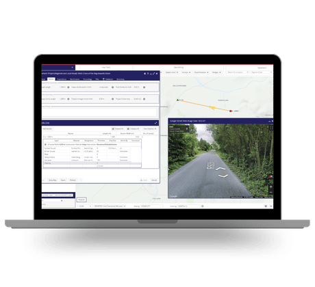
MapRoad AMS puts every road asset, from bridges and drainage to public lighting and speed data, in one system. Built on open-source technology, it adapts to new standards and legislation without a costly overhaul.

Outside of Trinity College

An Integrated Digital Workflow, from Survey to Funding

MapRoad AMS brings the full road asset management process into one place: assessing pavement condition, creating and submitting projects, recording construction, and closing out funding programmes for the Department of Transport.

  • Specialised modules for Pavement Management (PSCI), Speed Limits, Road Traffic Collisions (LA16), Traffic Counts, Bridge Inventories, Works and Active Travel infrastructure.
  • Mobile data capture for surface condition, speed signage, collisions and bridges, using standardised engineering codes.
  • Open standards (OGC WMS/WFS and RESTful APIs) to share data with national systems such as TII, the NTA and Tailte Éireann, and with tools such as Power BI and Esri ArcGIS.
  • A continuously updated road network, maintained by field engineers. The Road Schedule captured in MapRoad AMS is now considered the legislative standard for all roads authorities.


Decentralised Control, Standardised Oversight

12 data entry tools, a suite of mobile apps and over 100 integrated datasets, giving engineers decentralised control with standardised national oversight.

83% of Regional and Local Roads Now Rated 7–10

With targeted, evidence-based investment, road conditions have consistently improved. In 2023, 83% of regional and local roads were rated between 7 and 10, up from 72% in 2016, and roads in the worst condition ratings (1–4) accounted for just 2%.

The Department of Transport allocated €405m in 2025 to regional and local road protection and renewal, all managed through MapRoad AMS.

Solution Benefits

  • A single, national source of truth for road assets, used by more than 1,000 engineers across all 31 local authorities.
  • Asset management for over 102,000 km of national, regional and local roads, and c.650 km of active travel infrastructure.
  • Prioritisation of c.8,000 road projects and distribution of c.€600m of national funding each year, with transparent, auditable reporting.
  • National harmonisation of pavement condition ratings through PSCI standards, enabling fair comparison and better-targeted investment.
  • Measurable improvement in road condition: 83% of regional and local roads rated 7–10 in 2023, up from 72% in 2016.
  • Enhanced road safety planning through spatial analysis of collisions and speed zones.
  • No per-user or per-organisation licence fees for more than 31 organisations and 1,000 users, with the RMO in control of the product roadmap.
  • A trusted national dataset shared with national agencies and academic institutions, ready to extend to climate resilience, noise mapping and predictive maintenance.

Our Partnership Gives You Access to a Network of Expertise and Solutions

By partnering with Tracsis Group entities such as Tracsis Geo Intelligence clients gain access to a broad and complementary portfolio of leading solutions, spanning operations analytics, asset management, digital rail technology, geospatial intelligence and data analytics. Tracsis Geo Intelligence is operated by Compass Informatics UK Ltd, a UK-registered company.

Get in touch